Pictured Rocks National Lakeshore Adventures
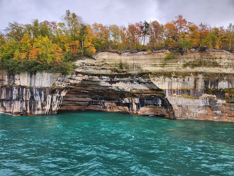
Pictured Rocks National Lakeshore stretches along Lake Superior’s southern shoreline, offering dramatic multicolored sandstone cliffs, pristine beaches, and lush forests perfect for outdoor enthusiasts.
Popular Activities
Plan Your Visit
Everything you need to know to prepare for an unforgettable trip to Pictured Rocks National Lakeshore.
Entrance Requirements
No entrance fees; certain areas may require parking permits.
Best Time to Visit
Best visited from late spring to early fall for optimal hiking and kayaking conditions.
Visitor Information
Munising Falls Visitor Center and Grand Sable Visitor Center.
Getting There
Access via Michigan State Route M-28 through Munising or from the east via Route H-58. Some road closures may occur in winter.
Weather & Climate
The area experiences warm summers with temperatures averaging in the 70s (F), while winters are cold and snowy. Fall provides vibrant foliage, and spring sees a return of lush greenery.
Conservation Efforts
Concerns include shoreline erosion and the impact of invasive species on local ecosystems. Conservation efforts focus on maintaining the natural habitat and promoting sustainable visitor practices.
Camping in Pictured Rocks National Lakeshore
Find the perfect spot to stay overnight and immerse yourself in the details.
Little Beaver Lake Campground
Offers lakeside sites with access to the Beaver Basin area.
Hurricane River Campground
Located near the Historic Au Sable Light Station with beach access.
Top Trails
Chapel Loop Trail
A scenic loop passing stunning sites like Chapel Rock and Chapel Falls.
Mosquito Falls and Beach Trail
Winds through forested areas to a beautiful waterfall and beach.
Miners Castle Trail
A short trail leading to an iconic overlook of Lake Superior.
Beaver Lake Loop Trail
Circles Beaver Lake, offering diverse landscapes and wildlife viewing.
Trailblazer Tips
Kayaking offers the best views of the cliffs close-up.
Spring and fall bring fewer bugs, making for a more comfortable hike.
Campgrounds fill up quickly in summer; plan and book early.
Bring waterproof gear to prepare for sudden weather changes on Lake Superior.